Written by: I Gusti Ayu Septiari and Dewa Kresnanta. Translated by: Hamzah
At night, while a number of farmers were fast asleep in their homes, heavy equipment barged in. The incident took place in September 2024, at 10:30 p.m. Central Indonesian Time.
Day after day, time after time, the heavy machinery kept forcing its way in, angering the farmers, who blocked it over and over. The event left trauma for Semiasih, one of the farmers in the Bunung Batur Bukit Payang forest area, Kintamani District, Bangli Regency, Bali.
“I’m still traumatized from when the company entered. I had lots of crops there, the onions were still in great shape. I lost around Rp60 million at that time because the water pipes were cut,” explained Semiasih when met at her residence on Thursday, June 11, 2026.
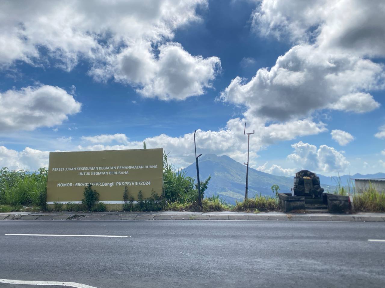
The arrival of this heavy equipment is one of several events linked to the burgeoning development of tourism in Kintamani.
Kintamani is a district in Bangli Regency located in the highlands. It sits around 1,500 meters above sea level, encircling Mount Batur, an active volcano in Bali.
The history of Kintamani as a tourism area
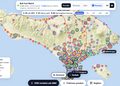
Click to view the interactive data visualization
We conducted a historical search through media reports and open sources to understand the development of the Kintamani area.
The status of the Mount Batur area has changed several times since the 1926 eruption. From a conservation area during the Dutch East Indies era, it was expanded to Panelokan as a tourism forest, and later designated a Taman Wisata Alam (TWA – Nature Tourism Park) in 2014. The Mount Batur-Bukit Payang TWA covers 2,528 hectares, while the Panelokan TWA spans 574.27 hectares.
As a tourism destination, Kintamani is also a disaster-prone area. Over time, various incidents have occurred here. In 2017–2018, landslides struck Kintamani.
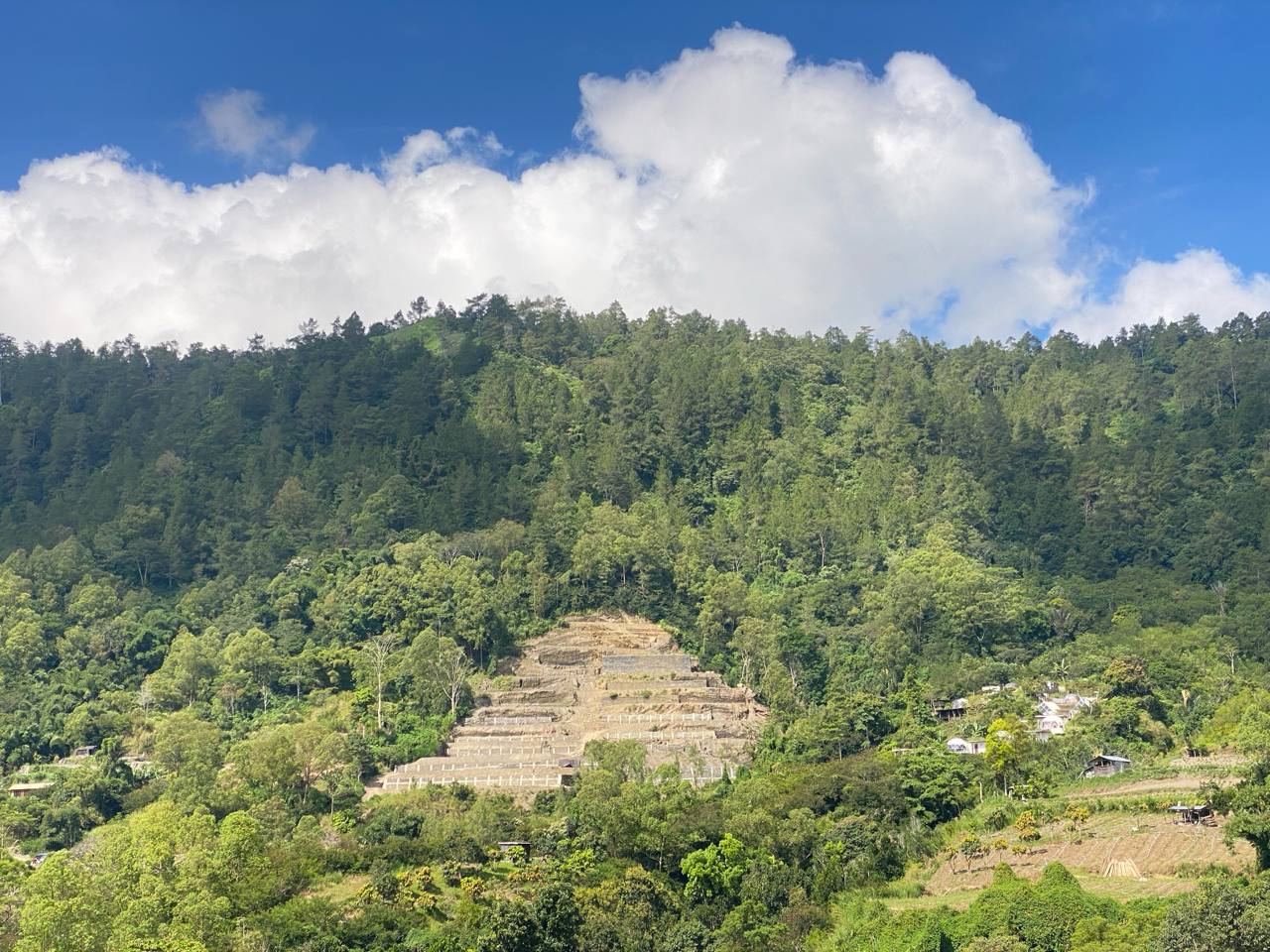
The following year brought a different pattern. Although landslides and fires still occurred, development in the forest area began to stir. In 2019, there were allegations of villa construction in the forest area. However, as reported by Kompas.com, the government denied this, claiming they were legitimate nature tourism facilities and infrastructure.
The Covid-19 pandemic temporarily slowed tourism in Bali. But it did not halt the pace of development. In 2020, a fire broke out in the HPKC Block of the Mount Batur – Bukit Payang TWA. The location was near Jalan Raya Toya Bungkah. As reported by Bali Post, there were suspicions of land-clearing efforts.
After Covid-19, numerous buildings appeared in the Batur Forest area. In 2022, the Civil Service Police Unit sealed a number of commercial buildings on Jalan Raya Batur. That same year, the government, through the Ministry of Environment and Forestry (KLHK), issued a Nature Tourism Facility Business Permit (PB-SWA) to PT Tanaya Pesona Batur (TPB).

A year later, the construction of a recreational park by PT TPB was rejected by residents living in the TWA, or Mount Batur Bukit Payang Forest. Two years after that, residents in the Panelokan TWA also protested against concrete buildings in the disaster-prone area.
Responding to the surge of development in Kintamani, the Bali Natural Resources Conservation Agency (BKSDA), as the manager of the two TWA areas in Kintamani, launched the “The New Kintamani” concept.
Through this concept, BKSDA proposed several arrangements: from tourism jeep activities, climbing activities, land-use management, managing vendors at the summit, and finalizing definitive permits for investors.
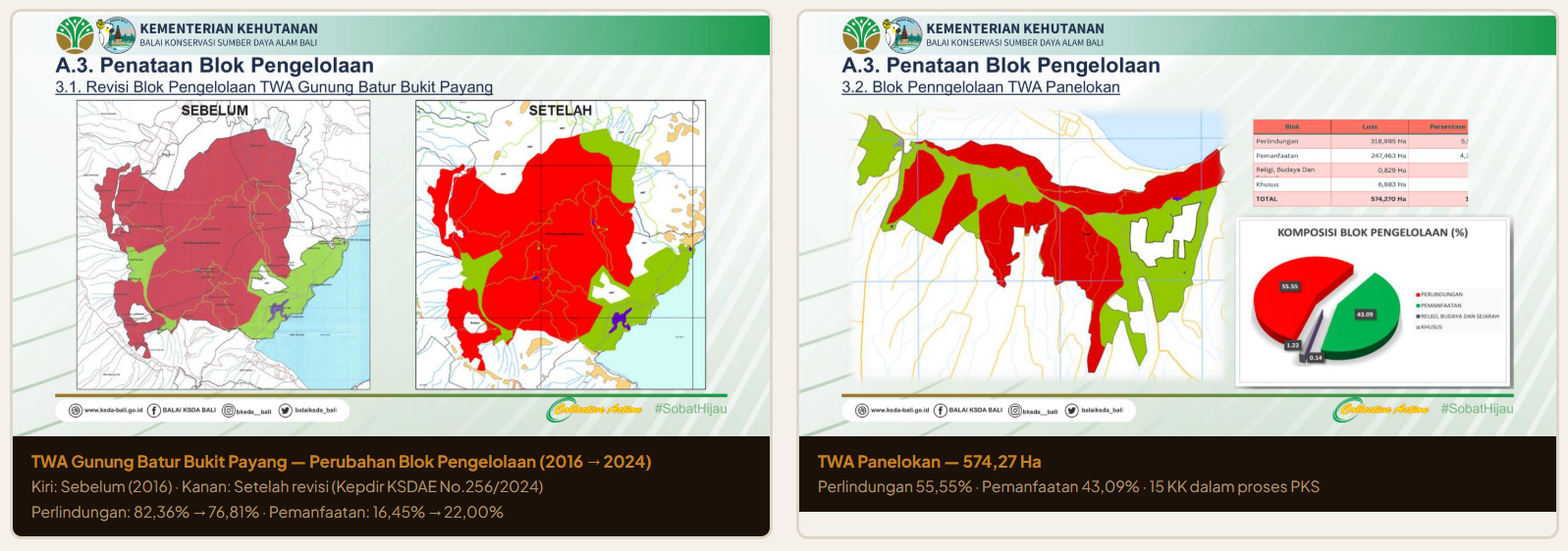
TWA management is based on spatial zoning: protection blocks, utilization blocks, religious blocks, and special blocks.
Click to view the interactive data visualization
In the latest management zoning, BKSDA Bali has narrowed the protection block in the Mount Batur-Bukit Payang TWA. In 2016, the protection block comprised 82.36% of the total TWA area. This was reduced to 76.80% in 2024.
Meanwhile, the utilization block increased from 16.45% of the total Mount Batur-Bukit Payang TWA area to 22% in 2024.
The use of the TWA area falls into two contexts. Public use is intended for the general public wanting to enjoy the scenery, camp, hike, or take jeep tours and motocross rides. The other use is for corporations, namely investors. Investors can obtain permits to build nature tourism facilities such as glamping and nature tourism services.
According to the Head of BKSDA Bali, Ratna Hendratmoko, there is currently one definitive permit in the Mount Batur-Bukit Payang TWA, held by PT TPB. Meanwhile, several other business permits are still being processed.
“Now, for Panelokan TWA, that’s where most are. All four are still in process,” explained Moko regarding the status of business permits in the Panelokan TWA.
Kintamani is increasingly sought after by investors. Yet, this expansion of business permits is inseparable from one often overlooked fact: the threat of disaster in Kintamani.
Kintamani is disaster-prone

Development in Kintamani is hazardous because the area is located in a disaster-prone zone. Historically, the eruption of Mount Batur completely transformed the space in Kintamani.
The dense population in Kintamani exacerbates vulnerability to disasters in the Mount Batur area. This was revealed in an ongoing 2022 study by the National Research and Innovation Agency (BRIN), “Evaluating Population and Infrastructure Exposure to Mount Batur Volcanic Risk.”
The research states that population density around Mount Batur can worsen the risk during an eruption. It estimates that 17,461 people live within the volcanic hazard zone of Mount Batur. That figure represents 16.01% of the total population of Kintamani District. Of the 19 administrative villages around Batur, 8 have settlements within the hazard zone: Batur Selatan, Songan A, Batur Tengah, Songan B, Sukawana, Kintamani, Pinggan, and Kedisan.
The study notes that parts of Songan A, Batur Selatan, and Batur Tengah villages are the most densely affected. This is because these three villages are closest to the high-potential zone prone to pyroclastic flows, lava flows, lava bombs, and toxic gases.
Mount Batur in Kintamani is an active volcano that last erupted in 2000. Oka Agastya, a Geoscientist at Batur Geopark, explained that based on its eruption history, Mount Batur has a roughly 20-year eruption cycle.
“Mount Batur has a characteristic: if it experiences more than 10 volcanic earthquakes in a day, that indicates signs of an impending eruption,” Oka explained when met on Tuesday, June 9, 2026.
It is difficult to predict exactly when Mount Batur will erupt. However, Oka says there is magma already close to the earth’s surface. “It’s just waiting to cough it up,” said Oka.
History records that Mount Batur’s largest eruption occurred from August to September 1926. It destroyed the original Batur Village and Karanganyar Village on the southwest foot of the mountain. This event is known as Rarud Batur; the surviving residents fled en masse and built new settlements in a safer area.
Oka explained that after the eruption, there were changes and a reorganization of living space. The Dutch colonial government at the time secured the area, deeming it a disaster-prone zone. This was done by designating about half of the area around Mount Batur as a conservation zone.
Long before the 1926 eruption, an ancient Mount Batur erupted around 29,300 to 30,000 years ago. That eruption formed the caldera and Lake Batur, which is now a tourist destination. Oka noted that, in terms of contour, the area outside Mount Batur’s caldera is used as agricultural land, while the area inside the caldera has developed into land for tourism accommodation.
Despite standing on a disaster-prone area, the pace of development in Kintamani shows no signs of slowing. On the contrary, land conversion continues alongside the proliferation of the tourism sector.
Disaster-prone zones go hand in hand with land conversion
The agriculture and tourism sectors in Kintamani are now starting to balance out. Many locals take on dual jobs—trekking guides in the morning and farming during the day.
“Tourism is a recent phenomenon here,” said Oka.
Tourism in Kintamani has grown with a concept of temporary accommodation, such as glamping (glamorous camping). Oka believes the growth of glamping in Kintamani is influenced by the land’s contour, which lacks a spatial carrying capacity system.
“If it were permanent buildings, they’d probably be quite large, and it’s somewhat difficult to find a spot. You’d be lucky to find a place. It turns out that near a cliff, it isn’t technically supportive,” explained Oka.
As a tourist destination, Kintamani is often dubbed the land above the clouds. This attracts tourists, prompting investors to put their capital into building tourism accommodation in Kintamani.
Click to view the interactive data visualization
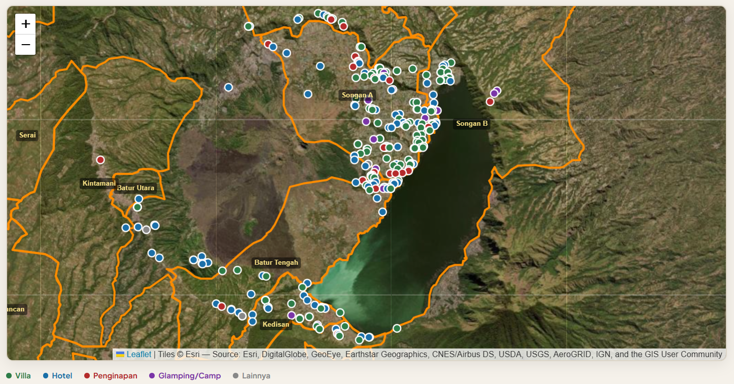
We scraped Google Maps to determine the number of tourism accommodations in Kintamani. The scraping was done in incognito mode to avoid search results based on user activity. Six keywords were used: Kintamani accommodation, Batur accommodation, Kintamani hotel, Kintamani glamping, and Kintamani villa. After collecting the data, we cleaned it to filter out irrelevant search results.
From the Google Maps scraping results, there are 289 tourism accommodations in Kintamani. The most common type is villas, with 135 of them. There are also 103 hotels, 19 glamping sites, 28 inns, and 4 other tourism accommodations.
More than half of the tourism accommodations in Kintamani are located in Songan A Village, totaling 154. Based on the Google Maps scraping results, the dominant type of accommodation in Songan A Village is villas, with 84.
The growth rate of tourism infrastructure in Songan A Village can also be seen from land cover changes in Kintamani. According to MapBiomas, from 1990 to 2024, Songan Village experienced increasing infrastructure development year by year. The MapBiomas data shows the red areas, representing settlements and infrastructure, expanding, while green vegetation cover is shrinking.
In addition to Songan A Village, infrastructure growth is also occurring in its neighboring administrative village, Batur Tengah. Historical Google Earth maps show infrastructure growth around Lake Batur. In 2014, the shore area of Lake Batur was still empty. By 2025, that area had become densely built up.
Consistent with the historical Google Earth imagery, the Google Maps scraping results also show Batur Tengah Village as the second village in Kintamani with the most accommodations, totaling 45.
The surge of development does not always bring evenly distributed prosperity to local residents. In Kedisan Village, the third village with the most accommodations, residents are still struggling to meet their most basic needs.
Water crisis behind the grandeur of tourism accommodation
Communities in Kintamani face not only potential disasters. Residents of Konyel Hamlet, Kedisan Village, are still grappling with a clean water crisis.
Behind the bustling tourism activity, clean water access remains difficult for residents. Google Maps scraping results show 26 tourism accommodations standing in this village.
Viewed through the history on Google Earth, infrastructure growth in Kedisan Village is not as dense as in Songan A and Batur Tengah. In 2014, land in Kedisan was dominated by forest and farmland. Buildings were very rare—only scattered small houses. Roads were still narrow, winding paths following the valley’s contour.
By 2025, at the same points, dense buildings are visible. There are at least 3–4 clusters of tourism accommodation with uniform roofs. Three swimming pools are visible from satellite, all near large buildings. Meanwhile, forest and farmland cover around the buildings has shrunk. Areas that were once evenly green are now pockmarked by rooftops and open land.
Tourism accommodation development in Kedisan Village has occurred in areas adjacent to the Panelokan TWA, near the main road access.
Currently, three business permits are in process in the Panelokan TWA: PT Linggarjati Maris Makmur, PT Pucuk Bang Sujati, and PT Yeh Cissana Trishifa. One company’s land is close to Konyel Hamlet, Kedisan Village, Kintamani District, Bangli Regency.
Before 2023, Konyel Hamlet residents had to worry about clean water supply when the dry season hit. During the rainy season, they improvised by collecting water using tarpaulins. Residents without water storage would buy water from a private water company.
“I can buy five truckloads of water a month, at Rp250,000 per truck,” said Ni Wayan Rasmini, a Konyel Hamlet resident, when met at her home on Thursday, June 11, 2026.
Before there were water companies or household rainwater storage, Konyel Hamlet residents had to walk to a water source carrying jerry cans to meet their household water needs.
“It’s only 1 kilometer away,” said one Konyel resident.
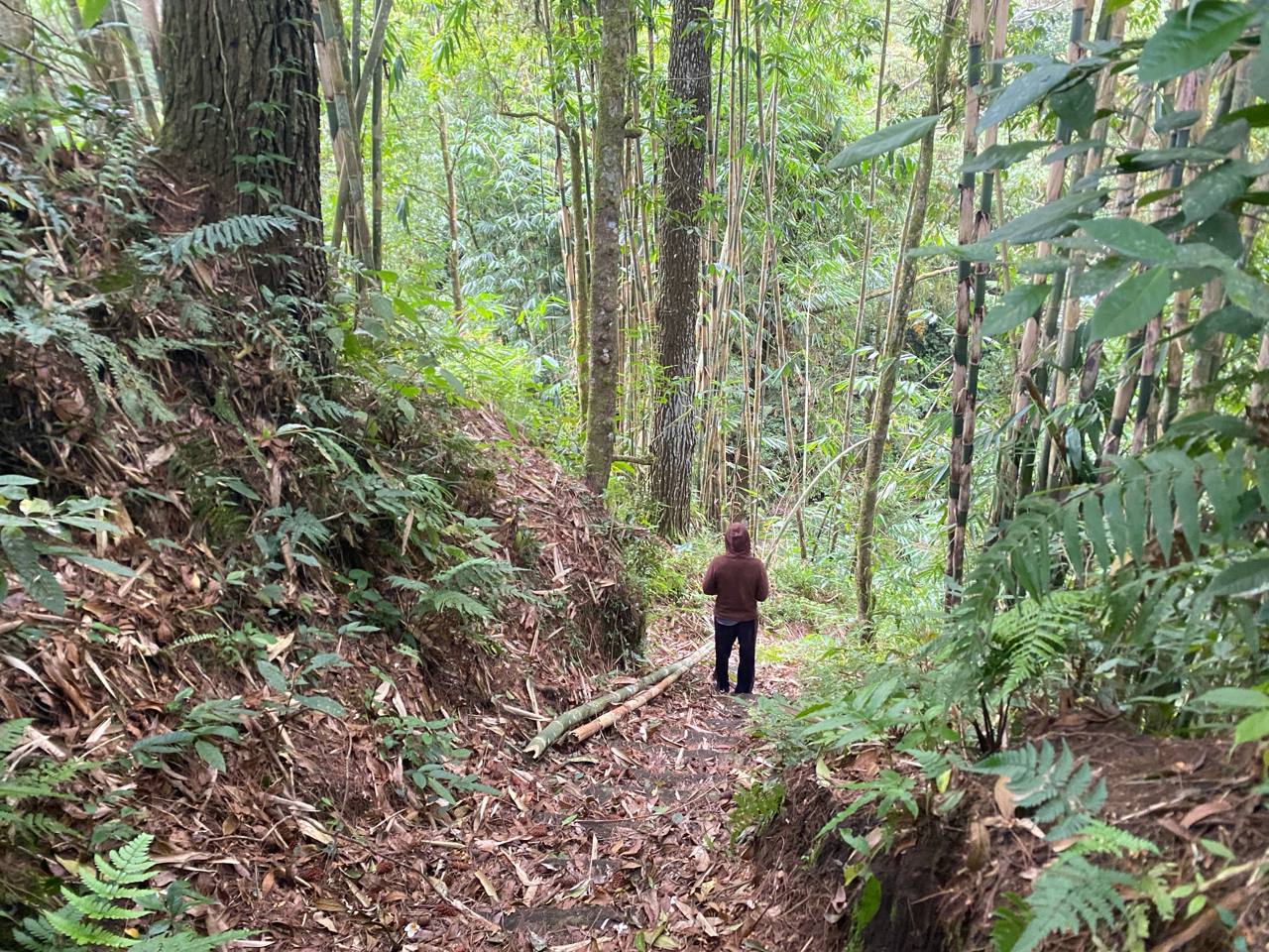
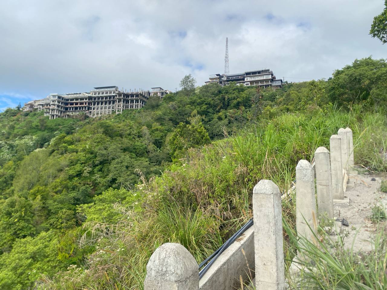
That 1-kilometer distance turned out to be a descent down a cliff toward a stream. The stream itself only appears during the rainy season. The rainy season also occasionally triggers landslides, making access to the stream difficult.
Above the stream, there is an old well already overgrown with wild plants. That old well served as a rainwater collector, where Konyel residents would draw water when their storage ran dry.
When the dry season arrives, Konyel residents’ time is consumed by transporting water. Consequently, residents who work as farmers lose time for their fields. Meanwhile, during the rainy season, their farmland is vulnerable to crop failure because landslides can occur at any time.
In 2023, with assistance from the Legal Aid Institute (LBH) Bali Women Crisis Center (BWCC), the old well was replaced with two new wells. These dug wells were fitted with water pumps and distribution pipes reaching residents’ homes.
Even though water access has been met, Rasmini and other Konyel residents cannot yet breathe easy. The construction of tourism accommodation is creeping ever closer to their land.
On the cliff leading to the dead stream left by a landslide, markers like stakes belonging to one investor have already been planted. The stakes bear the name PT Linggarjati Maris Makmur. Although not yet built, residents feel wary, drawing lessons from development in neighboring villages.
“Where can we find water if only villas exist? There’s no water absorption here; I hope massive development doesn’t happen here,” said Rasmini.
The threat of losing living space
While Konyel residents struggle for clean water in the Panelokan TWA, in the Mount Batur – Bukit Payang TWA, the threat is the loss of living space. It is not about the absence of infrastructure; Batur farmers are at risk of losing the land they have cultivated for decades. The threat came suddenly, in the form of heavy equipment forcing its way into community farmland.
This event is linked to the recreational park project planned by PT Tanaya Pesona Batur (TPB) within the Mount Batur-Bukit Payang TWA.
Tan Estate is a business of PT TPB that has been operating since February 14, 2025. Its construction is based on a Nature Tourism Facility Business Permit (PB-SWA) issued by the Ministry of Environment and Forestry (KLHK) in 2022.
Viewed through historical Google Earth satellite imagery, in 2015, the land where Tan Estate now stands was still vacant with few trees. No pier/jetty jutted into the lake. Meanwhile, plastic-roofed farmland already existed that year and was quite dense on the western side.
By 2025, Tan Estate stands with a pier extending into the lake. That pier is where the Royal Songan Cruise, provided by Tan Estate, docks and anchors.
Farmland still exists, meaning the resort and farming stand side by side. However, PT TPB’s development does not stop at Tan Estate. On the farmland of Semiasih and several other farmers, PT TPB plans to build a recreational park.
This recreational park is planned for an area of 85.66 hectares. The construction project encroaches on the farmland and homes of a number of Mount Batur Bukit Payang Forest farmers, abbreviated as Batur Forest.
Not far from Semiasih’s house, there is the home of her father, I Wayan Arimawan, also affected by PT TPB’s development.
That afternoon, I Wayan Arimawan lay on his bed. He is 80 years old. Arimawan has lived in Batur Forest, which has now become a TWA, for 63 years—since 1963, as he remembers it.
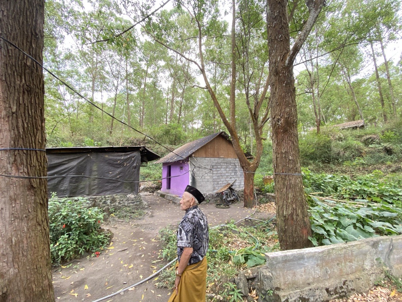
Living for years in Batur Forest, Arimawan preserved the forest by planting trees. When met at his home, Arimawan pointed to the towering trees around his house.
“I have been preserving this forest since 2001,” said Arimawan when met at his residence on Thursday, June 11, 2026.
In 2001, Arimawan and the government at the time made an unwritten agreement. Arimawan was allowed to live with a temporary structure in Batur Forest, provided he actively preserved the forest and protected it from fires.
“I occupy this land, so I preserve the forest, protecting it from fire over 113 hectares with my friends; there were only 13 of us here then (in 2001),” he said.
During his life in Batur Forest, Arimawan only built temporary structures. He dared not build a permanent structure because he realized his residence was in a forest area. He also moved from place to place several times.
Then, in 2023, an investor company approached Arimawan and a number of farmers in Batur Forest. The company offered Batur community members living in Batur Forest to move elsewhere.
The land where Arimawan and dozens of other farmers live was to be turned into a recreational park. However, Arimawan refused to give up his land.
“There are about 60 people who refused,” he said.
The entry of heavy equipment into residents’ land left lasting marks. The pipes on Arimawan’s land are visibly damaged, no longer able to channel water. Those pipes, it turns out, supplied water to Semiasih’s farmland.
Semiasih’s farmland is behind Arimawan’s house. Currently, the farming activity there has temporarily ceased. It is not because she doesn’t want to farm; Semiasih is traumatized about setting foot on her farmland.

Onions need watering twice a day. But the arrival of heavy equipment damaged the pipes carrying water to Semiasih’s onion fields. The heavy machinery ran over the water pipes. This resulted in the onion plants dying after going unwatered for weeks.
At her home, Semiasih was seen unloading vegetables from a car. After the incident, she decided to stop farming. She now works as a vegetable and onion collector, taking produce to the market.
Semiasih said that before the investor entered Batur Forest, the situation in the area was peaceful.
“It was calm and peaceful before. There was never any friction. We shared joys and sorrows with our neighbors. Not anymore—now everyone is indifferent. Because most neighbors are pro-PT (the investor),” Semiasih said.
The promised compensation is one reason Semiasih’s neighbors agreed to PT TPB’s development. As Arimawan said, residents were promised housing. The promise wasn’t limited to that; they were also promised jobs.
Semiasih and other residents who refused were not tempted by those promises. She looks at the situation at a large resort with hot springs not far from her home as an example.
“We used to be free to go in there to the hot springs. Now, you can’t even go in—entrance now costs money. That’s what I use as an example. Especially when a big company is involved. We might not be as free as we are now,” said Semiasih.
The threat of the recreational park makes Semiasih and other residents worry they will no longer have free access to their land.
All this time, Semiasih and her family have lived off farming. She feels her living space is threatened by the arrival of investors.
An onion farmer like Semiasih can earn Rp50 million to Rp100 million in one harvest. Besides onions, farmers in Batur Forest also rely on income from vegetable farming. Some also work as fishermen.
Meanwhile, Batur residents who do not own farmland prefer to work as farm laborers. In a day, farm laborers are paid Rp200,000, so in a full month they can earn up to Rp6 million.
That figure is nowhere near what the investor offered residents.
Let’s call him Abe. Abe is a Batur resident who was lured with a job by PT TPB. Abe works at Tan Estate based on a land compensation offer. Each month, he receives a wage of only Rp1.5 million.
“Meal times are limited. I’m not allowed to leave for traditional ceremonies, or my salary gets heavily cut,” he said.
Abe’s resignation was also made difficult with the threat of a fine.

Click to view the interactive data visualization
The proliferation of tourism activity has made Semiasih and a number of Batur residents dare to build permanent houses. Semiasih’s house, which she now lives in, is only four months old—at the earliest, built in early 2026.
“We’re just following what’s here,” Semiasih said, pointing to a tourism accommodation building in front of her house, which stands as a permanent structure.
Just like Arimawan, Semiasih is not swayed by the lure of a house replacement from the company.
“They offered for us to move from here. We asked them to build it first, then we’ll move,” said Semiasih.
In reality, it has been three years since the offer was made, but PT TPB has yet to build the promised houses for the residents.

On August 5, 2025, Batur farmers who could no longer tolerate the investor’s actions filed an environmental administrative lawsuit at the Jakarta State Administrative High Court (PTUN). Assisted by the Bali Legal Aid Institute (LBH), the Batur farmers sued the Director General of Natural Resources and Ecosystem Conservation (KSDAE) of the Ministry of Forestry. The reason: the Director General issued an approval letter exempting the mandatory Environmental Impact Analysis (AMDAL), which led to the issuance of PT TPB’s business permit.
In a press conference on Wednesday, April 15, 2026, LBH Bali revealed that the issuance of the AMDAL exemption could only be done by a regional head to the minister. The exemption was also granted before Bangli Regency had a Detailed Spatial Plan (RDTR), even though the RDTR is needed for validation by the minister.
However, the lawsuit filed by the Batur farmers was rejected by the judge on the grounds that the lawsuit mechanism was submitted on behalf of individuals, not as a citizen lawsuit. To this day, Batur farmers are still fighting for their land by filing an appeal to the Jakarta PTUN.
Responding to the conflict between the Batur community and PT TPB, Head of BKSDA Bali, Ratna Hendratmoko, said his agency is merely acting as a facilitator.
“I have apologized, I have knelt before the residents who are refusing. I went down to apologize accompanied by LBH friends. I also offered a middle-ground solution,” said Moko when met at his office on Wednesday, June 10, 2026.
Moko stated that PT TPB is only utilizing a small fraction of the 85.66 hectares with a business permit. “What is being used is less than 10%. No one will be evicted,” he said.
Moko did not deny that the two TWAs in Kintamani have slipped from oversight. He merely conveyed that his agency would provide communication to find a middle ground between the involved parties.
The Mount Batur area, which was once a conservation zone during colonial times, is now being occupied by investors. The history of deadly eruptions is increasingly buried under a tourism image built after the Dutch colonial era.
Yet, as Oka and the BRIN research point out, the Mount Batur area is a disaster-prone zone. Its eruptions cannot be predicted. Dense human activity only worsens the disaster risk when an eruption occurs.
The impacts felt by residents due to development are already happening today: Arimawan’s threatened land, Abe’s far-from-decent wage, Semiasih’s trauma, and the residents of Konyel Hamlet struggling alone for clean water access while keeping an eye on investor stakes around their homes.
Instead of reinforcing the Mount Batur area as a disaster-prone zone, the government has sanctioned infrastructure growth in the area through the New Kintamani concept. In the area most vulnerable to disasters, the government is expanding utilization zones. In the end, development continues, encroaching on the land of people who have lived there for decades.
This report was supported by the Indonesia Data Journalism Network (IDJN) through the Data Journalism Hackathon 2026 fellowship.
Original article in Indonesian: